Home / General / County Level Election Maps

County Level Election Maps

/
/
/
2183 Views

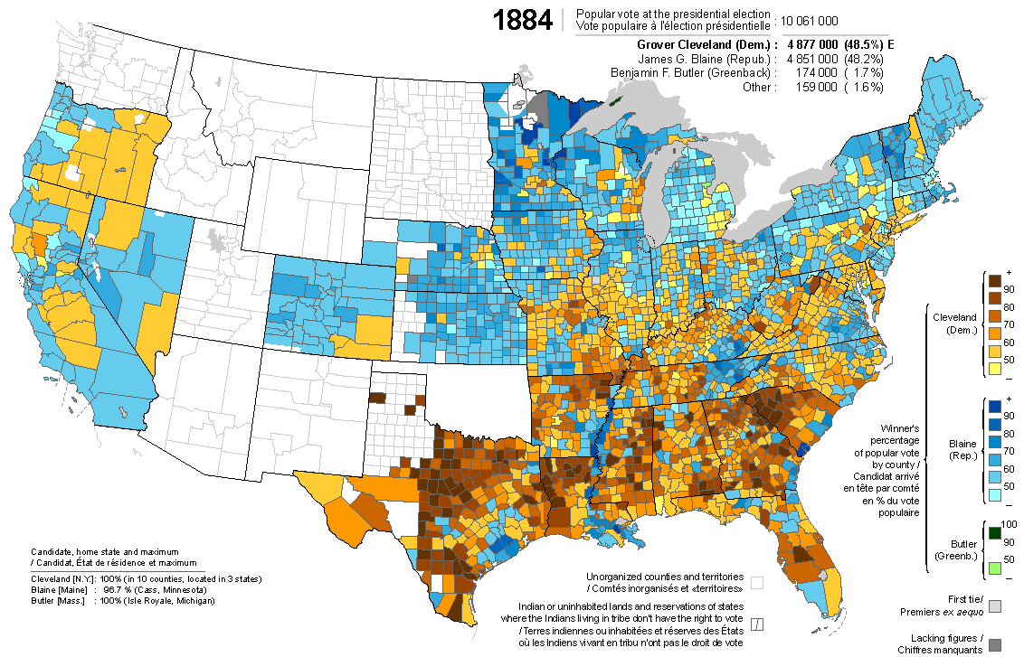
This is just a great way for political/historical nerds to kill a couple hours. It’s a site that has compiled county level presidential electoral information going all the way back to 1828. Want to see which counties actually supported Republicans in 1936? Here you go! What did the internal politics of northern states look like in 1860? Boom! What about the wackiness of 1912? Have at it! There’s even a special Debs map for that year!

  • Facebook
  • Twitter
  • Linkedin
This div height required for enabling the sticky sidebar
Ad Clicks : Ad Views : Ad Clicks : Ad Views : Ad Clicks : Ad Views : Ad Clicks : Ad Views : Ad Clicks : Ad Views : Ad Clicks : Ad Views : Ad Clicks : Ad Views : Ad Clicks : Ad Views : Ad Clicks : Ad Views : Ad Clicks : Ad Views : Ad Clicks : Ad Views : Ad Clicks : Ad Views : Ad Clicks : Ad Views : Ad Clicks : Ad Views : Ad Clicks : Ad Views : Ad Clicks : Ad Views :